What Happens When Borders Get Blurry on Lake Champlain?
Picture this: you’re out on Lake Champlain, rod in hand, the water stretching out in every direction. It’s easy to forget you’re straddling an international border. That’s exactly what happened to one fisherman who found himself at the center of a cross-border standoff. He claimed he was casting his line in Canadian waters, but the U.S. Coast Guard had a different take—and things escalated fast.
Why Are Lake Champlain’s Borders So Confusing?
Lake Champlain is a natural wonder, but it’s also a jurisdictional headache. The border between the U.S. and Canada zigzags through the lake, and unless you’re staring at a GPS, it’s tough to know which country you’re actually in. Even seasoned locals can get tripped up by the invisible line. According to the International Boundary Commission, the border is marked on maps but not always obvious on the water, especially when weather or waves blur your sense of direction.
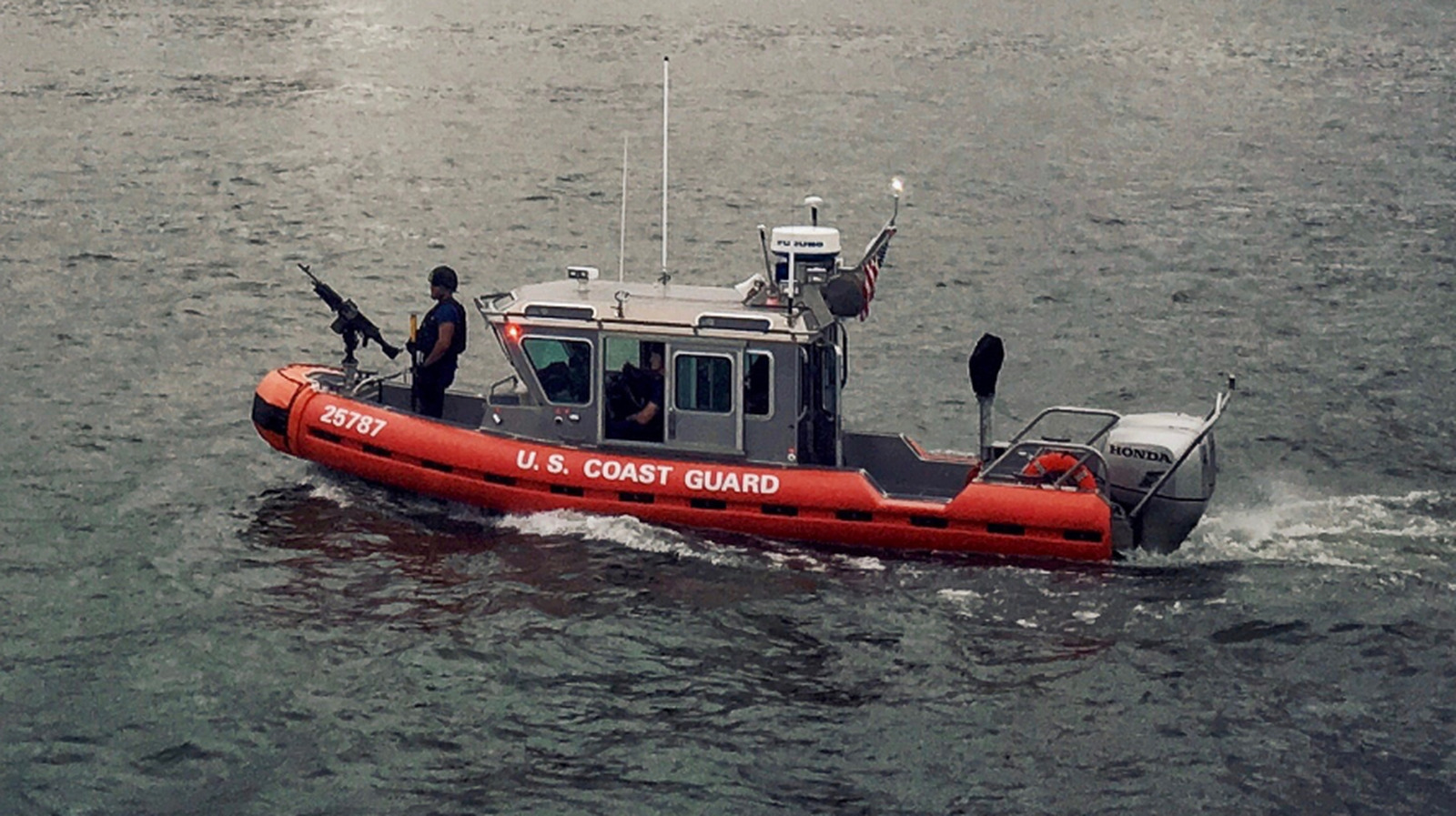
What Led to the Fisherman’s Boat Being Capsized?
Here’s where things took a dramatic turn. The U.S. Coast Guard, patrolling for illegal activity and border infractions, spotted the fisherman and decided he was on the American side. When they moved in to detain him, the situation escalated—his boat was capsized in the process. While the Coast Guard’s primary responsibility is safety and law enforcement, sometimes their actions can feel heavy-handed, especially when the facts are murky.
How Do Authorities Decide Who’s Right in These Situations?
It’s not always black and white. Both U.S. and Canadian authorities rely on GPS data, nautical charts, and sometimes even eyewitness accounts to determine jurisdiction. But technology isn’t foolproof. A 2022 study by the University of Vermont found that GPS signals on the lake can drift by several meters, enough to make a legal difference. When disputes arise, it often comes down to which side has the most convincing evidence.
What Rights Do Fishermen Have on Shared Waters?
If you’re fishing on Lake Champlain, you need to know the rules. Both countries require proper licenses, and crossing the border—even by accident—can mean hefty fines or worse. The Great Lakes Fishery Commission recommends carrying proof of your location and having both U.S. and Canadian permits if you plan to fish near the border. Ignorance isn’t a defense, and enforcement agencies have little patience for mistakes.
Could This Happen to Anyone?
Absolutely. In fact, cross-border incidents aren’t rare on shared lakes. In 2019, a group of Vermont kayakers were briefly detained by Canadian authorities after drifting north of the line. The lesson? Always double-check your position, especially if you’re near the border. A handheld GPS, a good map, and a healthy respect for international boundaries can save you a world of trouble.
What’s the Real Cost of a Border Misunderstanding?
Beyond the embarrassment and inconvenience, there can be real consequences. Boats can be impounded, fishing gear confiscated, and legal battles drawn out for months. According to Fisheries and Oceans Canada, cross-border infractions have increased by 12% over the past five years, thanks in part to better surveillance and more recreational boaters on the water. For most, it’s an expensive lesson in geography.
How Can You Stay Safe and Legal on International Waters?
Preparation is everything. Before heading out, check the latest border maps and make sure your navigation equipment is up to date. Download official boundary coordinates onto your GPS. If you’re stopped by authorities, stay calm and cooperative—arguing rarely helps. And if you’re ever in doubt, err on the side of caution and steer clear of the border.
The big takeaway? Navigating Lake Champlain isn’t about perfection—it’s about smarter adjustments. Start with one change this week, like updating your maps or reviewing border rules, and you’ll likely spot the difference by month’s end.